A 10-minute drive in the Livermore Valley can feel like changing seasons. One ridge is breezy and cool, while a nearby bench is warm and still. If you are exploring acreage or a vineyard-capable estate, these micro-shifts can shape your daily comfort, grape quality and long-term value. This guide explains what drives Livermore’s microclimates and how to use them to your advantage when you buy. Let’s dive in.
Why Livermore has microclimates
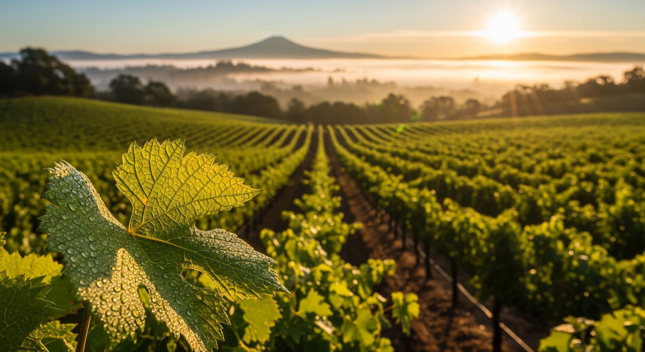
Livermore sits in an inland East Bay valley with hills on both sides, which creates distinct pockets of weather over short distances. The overall pattern is Mediterranean, with cool, wet winters and warm, dry summers. Local factors like marine influence, wind, elevation and slope aspect make one parcel feel very different from another.
Microclimates matter because they affect how you live and what you can grow. Afternoon sea breezes and fog influence comfort and energy needs. For vineyards, temperature swings, wind and sunlight exposure influence ripening, acidity and water use. Matching the site to the right use helps protect your investment and supports resale.
Marine influence and fog
Pacific marine air reaches Livermore through lower-elevation gaps, including the Altamont Pass corridor. The strength and timing of that marine push change by season and weather pattern.
What you will feel day to day
- Afternoon and evening breezes often cool the valley after warm days, creating larger day-to-night swings.
- Fog and low clouds show up more near western margins and wind channels. Inland pockets and higher elevations see less fog.
- Cooler mornings in fog-prone areas can reduce early sun exposure, while sheltered sites warm faster.
What it means for vines and value
- Marine cooling preserves acidity and can lengthen hang time for balanced wines.
- Cooler pockets often suit certain whites and earlier-ripening reds. Warmer, well-exposed slopes can favor red varieties that like heat.
- Showing clear evidence of a site’s marine influence and diurnal range can support marketing and buyer confidence.
Wind patterns and exposure
On most warm days, inland heating pulls onshore breezes through gaps. There are also larger weather events that can bring stronger, sustained winds.
- For vines, wind reduces humidity around leaves, which can lower disease pressure. It also increases transpiration, which affects irrigation needs and berry size.
- For comfort, exposed ridge-top homes feel wind more often, which can cool patios and increase heat loss. Sheltered hollows are calmer but may trap cool air at night.
- High-exposure parcels may need windbreaks, stronger trellis systems and thoughtful siting for outdoor living areas.
Elevation, slope and cold-air drainage
Elevation and slope direction change how a parcel warms and cools.
- Higher elevations are usually a bit cooler, with more wind exposure and better air drainage.
- South and southwest slopes receive more sun and heat, which can speed ripening.
- North slopes stay cooler and can help retain acidity, which suits certain styles and varieties.
- At night, cold air drains downslope and pools in low spots. Valley bottoms and swales are more frost-prone in spring and fall.
For both homes and vineyards, mid-slope and ridge-top sites often enjoy better drainage of cold air, lower frost risk and expansive views. Valley floors can be fertile and easier to irrigate but may face fog and frost.
Soils and surface drainage
Livermore soils vary from deeper alluvial deposits on the flats to coarser, well-draining soils on slopes and benchlands.
- Well-draining soils reduce waterlogging risk and often suit vines that prefer limited water.
- Deeper, fertile soils can drive vigorous vine growth and may require more canopy management.
- Before planting or major landscaping, plan on simple field texture tests and a lab analysis to confirm depth, drainage and any restrictive layers.
Fire and land management
Aspect and wind exposure influence how a landscape dries and how fire behaves.
- South and west aspects dry faster in summer and can be more flammable.
- Ridge-top exposures with stronger winds can see faster fire spread.
- Review county and state maps for hazard designations, understand defensible-space requirements, and document fuel reduction work as part of your due diligence.
Varietal choices by microclimate
Matching grape variety to site conditions supports both wine quality and resale.
- Warm, well-drained south or southwest slopes and sheltered benches: often favorable for warm-climate reds such as Cabernet Sauvignon, Zinfandel, Petite Sirah and Rhône reds.
- Cooler pockets, north-facing aspects and areas with stronger marine cooling: often suit whites like Chardonnay and Sauvignon Blanc, plus select earlier-ripening reds.
- Larger day-to-night swings can help accumulate sugars while preserving acidity and aromatics, which many winemakers prize.
Windier locations may require sturdier trellising, closer spacing or windbreaks. Canopy design should balance sun exposure with protection from sunburn. Water demand rises with wind and higher solar exposure, so confirm water availability and understand local rules for wells and irrigation before you commit.
How to evaluate a parcel’s microclimate
You can gather useful microclimate insights with a systematic approach. Combine on-site observations with map reviews and conversations with local experts.
On-site checks to run
- Visit early morning to look for fog, frost or cold-air pooling, then return mid-afternoon to gauge wind strength and direction.
- Walk ridges and hollows to feel exposure differences and note any wind channels or gaps.
- Study vegetation for stress, vigor or past frost damage. Look for erosion signs after heavy rains.
- If possible, deploy temperature and humidity loggers for a season to document diurnal swings and frost events.
Maps and data to review
- Climate normals and local station data for temperature, precipitation and extremes.
- Evapotranspiration and growing-degree-day data for site-to-site comparisons.
- AVA boundaries and viticultural summaries to understand recognized characteristics.
- Soil maps to pinpoint series and drainage traits.
- Parcel, zoning and flood maps, plus fire hazard and defensible-space references.
- Topo, slope, aspect and satellite layers to read the terrain.
- Local networks of weather stations to spot fine-scale wind and temperature trends.
Questions to ask sellers and local pros
- Where does frost occur on the parcel, and how often has it been a concern?
- What varieties have been grown nearby, and how have yields and quality performed by block?
- What water sources serve the property, and are there well logs or tests on file?
- Are there soil test results, drainage notes or records of erosion control work?
- Have there been notable wind events or storm damage, and what mitigation exists?
- Are there permits, easements or conservation statuses that affect land use?
Specialists to engage early
- A local viticulturist or independent vineyard consultant to align variety, rootstock and trellis with your site.
- A licensed soil scientist or agronomist to profile soils and confirm drainage.
- A microclimate or wind consultant for larger estates where mapping matters.
- A land surveyor or hydrologist if water rights, drainage or floodplain questions are complex.
- Local extension and county agriculture offices for regional advisories.
How microclimate shapes resale and marketing
Properties that clearly fit their environment are easier to position and sell to informed buyers. Warm, well-exposed slopes suited to estate Cabernet are compelling to vineyard-focused purchasers. Cooler benches that produce elegant whites can be equally marketable when the story is documented.
Risk factors can weigh on value if not addressed. Persistent frost pockets, poorly drained low spots, chronic high wind exposure without mitigation, scarce water and elevated fire risk can narrow your buyer pool. On the other hand, well-documented microclimate data, soil tests, irrigation infrastructure, windbreaks, drainage improvements and defensible-space records all help build trust and support price.
Quick checklist to narrow target areas
- Pull parcel-specific topographic and aspect maps so you can see slope, aspect and elevation at a glance.
- Check climate normals and nearby station data for temperature and growing-degree-day baselines.
- Review county, flood and fire hazard maps, along with water availability references.
- Conduct at least one early-morning and one late-afternoon site visit; place data loggers if timing allows.
- Order a field soil probe and lab analysis.
- Speak with nearby growers or winery managers about micro-site performance.
- Consult a viticulturist for variety, rootstock and trellis recommendations before planting.
Choosing the right microclimate is about aligning your lifestyle and goals with the land. With a clear process and the right advisors, you can target parcels that deliver comfort, wine potential and long-term value. If you would like a calm, step-by-step approach to evaluating acreage and vineyard-capable estates, connect with The Kristy Peixoto Team for white-glove guidance.
FAQs
What is a microclimate in Livermore and why does it matter?
- It is a small-scale weather pattern shaped by wind, fog, elevation and slope. It influences comfort, grape ripening, irrigation needs and resale value.
How can I spot frost-prone areas on a parcel?
- Look for low-lying swales and valley bottoms where cold air pools at night, ask for historical frost records and review any on-site logger data from spring and fall.
Which slopes are best for Cabernet vs. Chardonnay?
- Warm, south to southwest-facing slopes often suit Cabernet and other warm-climate reds, while cooler north-facing or marine-cooled pockets often favor Chardonnay and certain whites.
Will wind make outdoor living difficult on ridge-top sites?
- Ridge-tops feel more wind, but thoughtful siting, windbreaks and design can improve comfort. Wind can be beneficial for vines when managed correctly.
What data should I review before buying a vineyard-capable estate?
- Check climate normals, nearby station data, evapotranspiration and growing-degree days, soil maps, parcel and flood maps, and fire hazard references, then verify with on-site observations.